.png)
11 Dash Line - The Geopolitical Lines of Conflict in the South China Sea
- THE GEOSTRATA

- Feb 17, 2024
- 9 min read
Updated: Aug 13, 2025
“Strategy without tactics is the slowest route to Victory. Tactics without strategy is the
noise before defeat.” - Sun Tzu, Chinese General
Maps are a great source of contentions among nations, one such example is the South China Sea. The disputes between China and its neighbours in this region have intensified in the recent decades. China has been employing diplomatic, military and economic means to achieve its strategic ends in the South China Sea. The existing tensions touched a new low during the pandemic as China established two administrative districts and opened new research stations in the Subi Reefs.
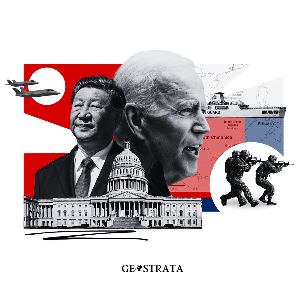
Illustration by The Geostrata
In 2021, the Chinese and Philippine navies encountered face offs. Indonesia and Vietnam in December 2022, announced the finalised boundaries with overlapping Exclusive Economic Zone (EEZ) claims to the Natuna Islands in the South China Sea leading to tensions over fishing and navigational rights as these countries’ EEZ overlap with China’s nine-dash line. The US-Japan-South Korea have built a united front against Beijing’s maritime expansionism.
Amid growing tensions with the United States over Taiwan, Beijing released the 2023 edition of the standard map of China by the Ministry of Natural Resources. This map covers the territories of Taiwan and most of the West Philippine Sea, particularly the contested Spratly Islands.
The Philippines refer to the South China Sea waters as the West Philippine Sea within their nation’s exclusive economic zone (EEZ). Additionally, the map brings the entire South China Sea including the EEZs of Brunei, Malaysia, Philippines, Vietnam and Taiwan, referred to as the 10-dash line.
The larger aim of the Communist Party of China (CCP) is to execute its planned reunification with Taiwan.
Experts say that the nine-dash line is a “maximalist claim to sovereignty and control over all of the features, land, water and seabed within the area bounded by the nine-dash line.
INCREASED MILITARISATION OF THE SOUTH CHINA SEA
The map released was heavily criticised and protested against from the neighbouring quarters.
The release of the map was strategically placed days after China’s coast guard formed a cordon to block supply boats delivering to Manila’s military outpost in Ayungin Shoal in the disputed waters.
Manila’s official statement takes this as China’s “purported sovereignty and jurisdiction over Philippines features and maritime zones has no basis under international law, particularly the 1982 United Nations Convention on the Law of the Sea (UNCLOS). Also, the Philippines announced its joint patrols with Australia and the U.S. in South China Sea waters. The main aim of these joint exercises is to contain China’s growing footprint in the region and US's consolidation of interests in greater South Asia.
China’s recent claims to 90% of the South China Sea is based on the U-shaped nine-dash line etched on map in the 1940s by a Chinese geographer. This dotted line was adopted from the Chinese maps in the 1940s representing Beijing’s claims which is the U-shaped ‘nine-dash line’, referred to as the ‘blue national soil’ by the Chinese.
China’s military presence has been increasing in the South China Sea. It aims to expand its presence in the region through its Belt and Road Initiative (BRI).
In counter to the U.S. warship patrolling in the Chinese-built islands, China deployed missiles in the sea and the counter measures by the neighbouring regional powers signify militarization of the maritime disputes.
WHAT EXPLAINS THE INTERESTS OF THE GLOBAL POWERS IN THE SOUTH CHINA SEA?
A report published by the UN Economic Commission for Asia and the Far East in 1969 found “substantial energy deposits' (hydrocarbon resources) in the waters off the Diaoyu region. This was when the People's Republic of China began embracing claims in a counter-response to the U.S.-Japan security alliance.
The relations between Japan and China became normal in 1972 deescalating the islands' disputes. In 1974 post the U.S end of adventure in Vietnam, the Chinese till this date maintain around thousand troops in the Paracels Islands.
The 1998 China-U.S Military Agreement failed. In 2008, China and Japan signed a joint Energy Accord for exploration of the resources in the gas fields in the East China Sea, however this accord has not been successful due to Japan’s allegation of China’s unilateral development of the Kashi field.
In May 2009, Malaysia and Vietnam filed a joint submission to the UN Commission for extension of their continental shelf beyond the standard 200 nautical miles which caused renewed tensions in the area. There have been overlapping claims in the Exclusive Economic Zones and has been a major source of contention and instability in the region.
The control of this region would also allow China to monopolise the strategic trade routes in the East and South China Sea for tanker shipments and in case of any future conflict it can impose trade blockades and establishment of military bases.
This would also act as a buffer zone in the Southern Chinese mainland. The U.S-Asean Ministerial meeting in 2010 and the negotiations on the Trans-Pacific Partnership affirmed the U.S interest in the South China Sea and the greater Asia-Pacific region.
In 2012, countering the Japan’s nationalisation of the Diaoyu Islands, China put forward its claims over the territorial sea baselines and increased their patrolling to challenge Japan’s status quo. The PLA has increased its military spendings to increase their maritime capabilities and have invested heavily in their deterrence capabilities.
It has developed forces like the Chinese Maritime Police, Maritime Safety Administration to consolidate their presence in the region.
With respect to relations with ASEAN, China has leveraged its trade ties, what is called economic leverage, as an effective tool in its foreign policy. It has also carried out exploration activities in the Vietnamese Exclusive Economic Zones. The Asia Rebalancing strategy of the US is evident in its foreign policy. The Chinese Anti Access and Area Denial capabilities as a counter to U.S’s Joint Operational Access concept.
HISTORIC RIGHTS OVER THE 11-DASH LINE
China has justified its claims over the South China Sea as historical grounds as the South China Sea were first discovered during China’s Han Dynasty. China also argues that a Chinese mission in the 3rd CE A.D. to Cambodia and the official and unofficial accounts during the period of Song and Yuan dynasties show that the South China Sea is within China’s national boundaries.

Cartography by The Geostrata
According to the book, Asia’s Cauldron by US Scholar Robert D. Kalpan, the origins of the nine-dash line is traced back to the official maps produced by the Chinese Kuomintang Nationalist Party.
As far as the historical timeline of events is concerned, post the Japanese invasion of the South China Sea Islands (1937) and the consequent control of the Diaoyu Islands by the U.S (1945), as communism was spreading in this region, the Kuomingtang led government made repeated claims to these islands.
China under the rule of the nationalist Kuomingtang party first demarcated the territorial claims in the South China Sea with an eleven-dash line on the map. This claim covers the majority of the area including the Pratas Islands, the Macclesfield Bank, and the Paracel and Spartly Islands, which was regained from Japan post the World War II.
As history moves forward, after the defeat of the Kuomintang government, they fled to Taiwan. As a result, currently both the People’s Republic of China and Taiwan officially claim ownership over the South China Sea.
The nine-dash line was originally an 11-dash line, drawn by a Chinese geographer Yang Huarein. In 1947, the 11-dash line was introduced and around 286 chunks of reef and rock were referred to as the South China Sea Islands.
The line had seen changes and shifts throughout the course of history with the changing relationship with Taiwan and increasing tensions with the U.S. and the neighbouring countries.
The treaty of San Francisco(1951) between the U.S. and Japan were not clear on the Diaoyu Islands be ceded to Taiwan and this remains a contentious issue in the present-day debate over sovereignty in the East China Sea.
In 1952, the 11-dash line became the nine-dash line, as China gave up its claims over the Gulf of Tonkin during the time of cordial relationship between China's Mao Zedong and Vietnam. In 1953, two dashes were removed from the 11-dash line as the territorial title for the Bach Long Vi Island was transferred from China to Vietnam. The first two lines lie with the Gulf of Tonkin, bordered by Vietnam and China.
At the time of the nine-dash line in the 1950s, the two states were politically close, each having a three-mile territorial sea.
According to both China and Taiwan, these lines represent the median line between the islands within the South China Sea and the larger landmasses surrounding the sea’s littorals. This again changed in 2009, when tensions between China and Vietnam arose, a map marked the nine-dash line included in the documents was sent by China to the UN. To sum up, the CCP’s 1953 nine-dash line continues to be the basis for its claims.
However, the historical rights theory has been criticized on various grounds. Firstly, there is not enough evidence to justify that China has controlled the South China Sea after the mid-17th century. Historian and writer Robert D. Kalpan argues that these land features and islands within the South China Sea are microscopic bits of earth without any trace of life.
THE LEGALITY OF THE CHINESE CLAIMS UNDER INTERNATIONAL LAWS
The Chinese argument of historic right or historic waters does not find a place in the UNCLOS laws. The legality of the nine-dash line is indeed very ambiguous and controversial in nature.
According to the United States Department of States, a historic claim might be one of sovereignty over the maritime space or alternatively, some lesser set of rights to the maritime space. The Article 10 (6) of the UNCLOS provides for the historic bay but it does not provide definition of such concept.
It is also interesting to note the dynamics of the domestic legislations to supersede the international laws. In June, 1998, China brought a law on the Exclusive Economic Zone and the Continental Shelf that reinforced the idea of the debatable historic rights of the PRC’s claim, aligned with its strategy of its rightful place in its so-called nine-dash line in the South China Sea.
In 2014, the Chinese government released a position paper on the matter of jurisdiction in the South China Sea Islands reinforcing that China has indisputable sovereignty over the South China Sea Islands, Parcel Islands, the Zhongsha Islands, the Nansha Islands and adjacent waters.
The nine-dash lines have been legally interpreted from various angles, one is its interpretation of the line as the limits of historic waters indicating the bounds of China’s sovereignty historically and traditional reaches, however, China’s claims on these maritime spaces are not specified properly.
The country has always focused on the development of bilateral negotiations not multilateral ones in the event of disputes in this region.
The UNCLOS has established principles and legal framework governing all uses of the oceans and the matters concerning the international waters are to be regulated by the rules and principles of general international law.
Moreover, it also provides for the conditions of the islands which have EEZ or continental shelf as well as their limits. Under this framework, the claims of China are unjustified. It is also important to note that all the states bordering the South China Sea- Phillippines, Vietnam, China, Indonesia, Malaysia and Darussalam are signatories to UNCLOS.
The counter claim by the Chinese is that the UNCLOS does not apply to the nine-dash line on the lines of non-retroactivity as the former law entered into force in 1994, which is 47 years later after the Chinese government’s submission of the official nine-dash line.
However, this argument does not stand valid under the UNCLOS Code of Conduct and Dispute Settlement Regime. The Chinese government does not accept any of the procedures provided for in Section 2 of Part XV of the Convention with respect of the disputes referred in Article 298 of the Convention including disputes regarding the disputes of sea boundary limitation or those involving historic bays.
The future of the troubling waters of the South China Sea lies in the diplomatic negotiations for upgradation of the 2002 Declaration of the Conduct of the States concerned in the South China Sea. The UNCLOS does not specifically address sovereignty issues related to the South and East China Seas.
In 2013, the Permanent Court of Arbitration in the Hague found that the Chinese nine-dash line claims have no legal basis. The court ruled that the land requirements under the UNCLOS for generating a 200-nautical miles exclusive economic zone as the extensions are the result of China’s land reclamation programme.
Additionally, it also pointed out that Beijing through its island-building activities affected the marine environment. The 2017 proposed draft South China Sea Code of Conduct Negotiating Text is yet to be brought into effect and made binding. China’s dominance in the ASEAN has hindered any effective legislation from solving the issue at least in the near future. To conclude, international law has not been able to effectively solve the territorial issues in the South China Sea.
BY SOURISHREE GHOSH
TEAM GEOSTRATA


The way you presented complex information so simply is remarkable. Place dominoes on a grid, match numbers to clever constraints, and solve daily brain teasers that test your math and spatial skills. It’s like a mix of Sudoku and classic dominoes with a twist! pips nyt
especially when direct-to-consumer sales bypass commodity markets. most profitable livestock for small acreage Ultimately, profitability hinges less on the species itself and more on aligning production with local market gaps, managing costs carefully, understanding regulatory
Similarly, insects such as crickets and mealworms are gaining traction as ultra-efficient protein sources requiring minimal land and water. Sustainable Small Scale Livestock Farming For larger operations, goats and sheep can be lucrative in regions with demand for specialty dairy, meat, or fiber,
Small animals like rabbits, chickens, and quail often offer attractive returns for small-scale farmers due to rapid reproduction cycles, Raising Livestock For Profit modest space requirements, and dual income from meat and eggs.
Profitable livestock typically include high-demand, low-maintenance animals like layer chickens, animals on livestock farming Profitable Livestock tilapia, goats, and honey bees, which offer strong returns through eggs, meat, milk, or pollination services